3D Scanners
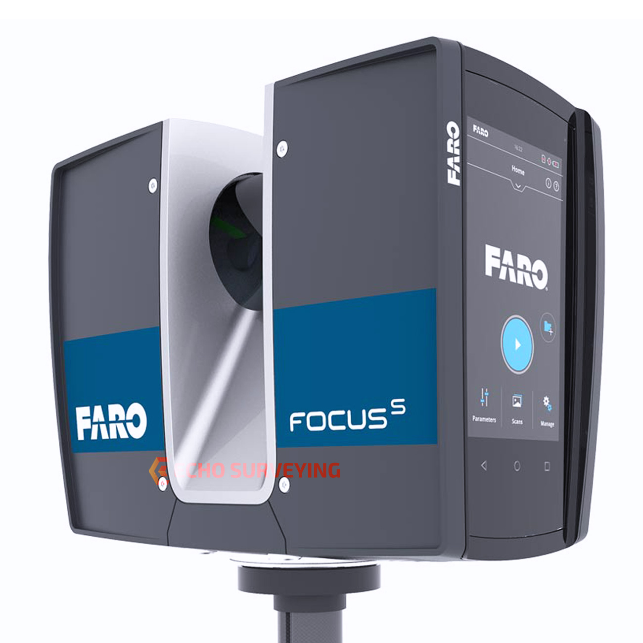
Terrestrial Laser Scaner – Faro S70
Ideal for fast outdoor scans with very low noise levels over long distances thanks to the range up to 70 m, speed up to 976,000 rpm and accuracy ± 1mm.
Range from 0.6m to 70m
Built-in HD High Dynamic Range (HDR) 2x / 3x / 5x photo recording camera for photorealistic 3D scans, via the built-in 165MPixels color panoramic camera with noise reduction of up to 50%.
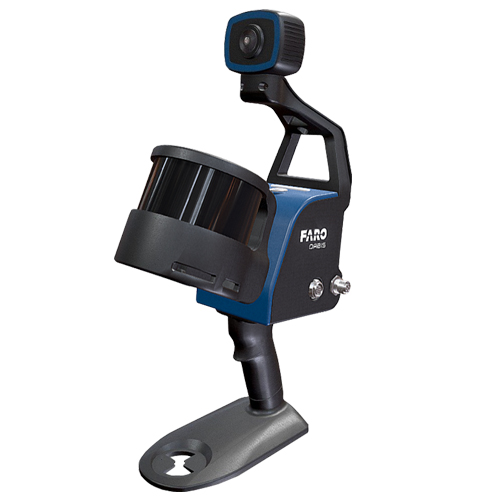
Faro Orbis Moblile Laser Scanner
FARO Orbis is an advanced handheld laser scanner (mobile laser scanner) that combines both mobile and static scanning. It integrates FARO’s FLASH technology, allowing for highly accurate static scans in just 15 seconds, as well as dynamic scanning while the user is in motion. It offers accuracy up to 5 mm during mobile scanning and up to 2 mm during static scanning using FLASH technology. It can operate both indoors and outdoors with a range of up to 120 meters. Designed to function in harsh environments such as underground mines, dense forests, or construction sites, it is capable of scanning even in complete darkness. It weighs only 3.6 kg.
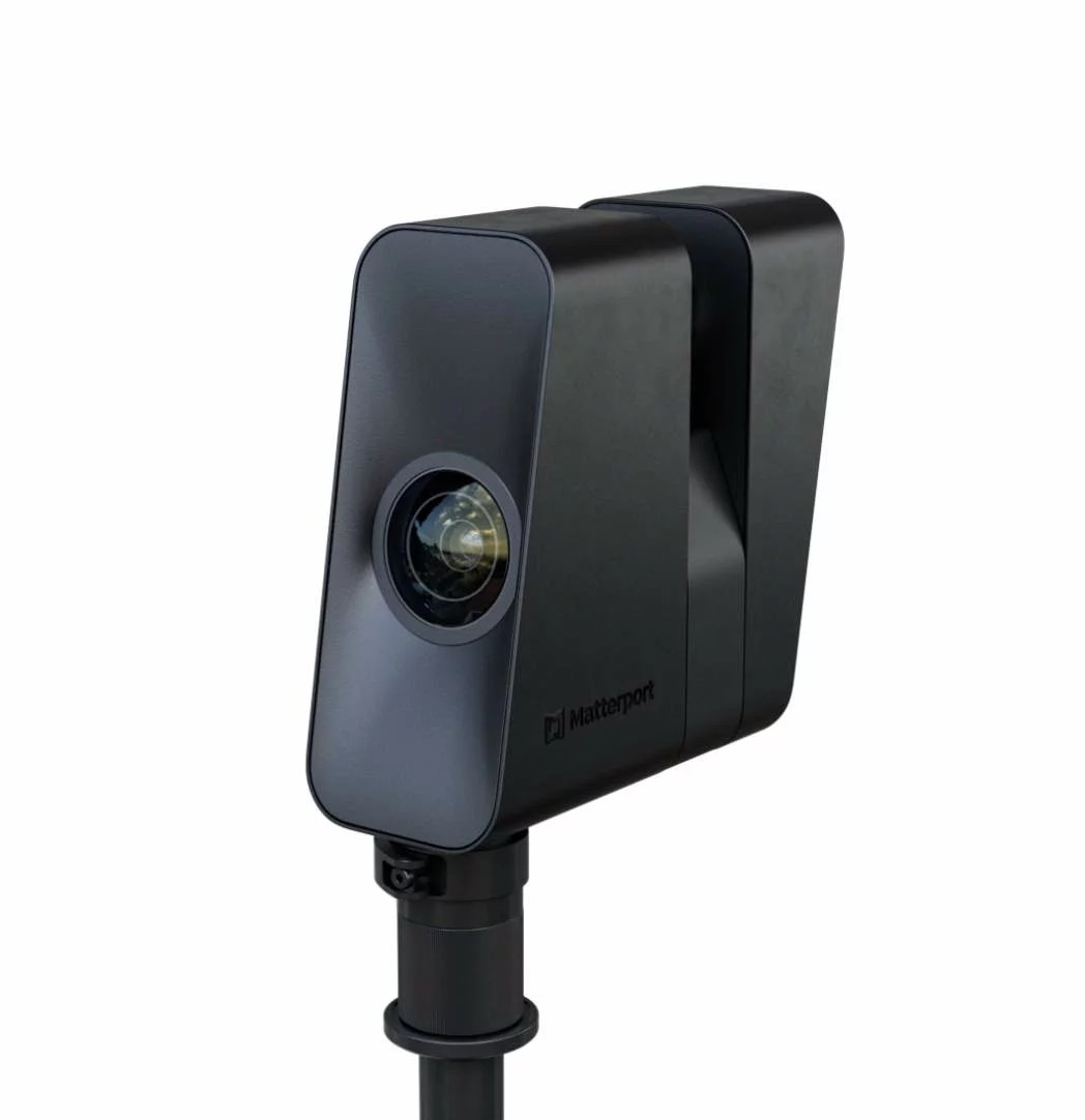
3D Camera Matterport Pro3
Matterport Pro3 is an advanced 3D scanning camera with LiDAR technology. The LiDAR sensor captures millions of measurements per scan with an accuracy of ±20 mm at 10 meters and a range of up to 100 meters. Each scan is completed in under 20 seconds, significantly speeding up the capture process. Equipped with a 20 MP sensor and a 12-element lens, it provides wide-angle coverage and vivid colors for realistic digital models. Weighing approximately 2.2 kg and featuring interchangeable rechargeable batteries, it enables continuous scanning throughout the day.
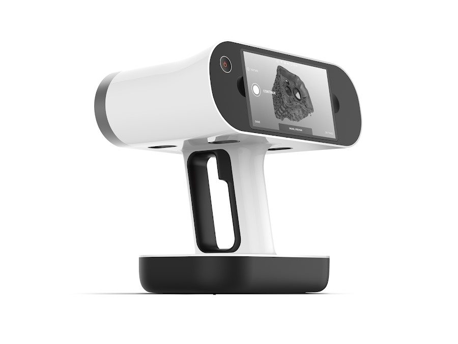
AI 3D Scanner – Artec Leo
Artec Leo is an advanced portable 3D scanner that offers wireless operation and high accuracy up to 0.1 mm and resolution up to 0.2 mm, with a data acquisition speed of up to 35 million points per second. It is suitable for scanning objects ranging from 20 cm to entire rooms, with a maximum capture volume of 160,000 cm³.
Technical specifications:
- 3D point accuracy: up to 0.1 mm
- 3D resolution: up to 0.2 mm
- Surface quality: 2.3 MP
- Colors: 24 bpp
- Dimensions: 231 x 162 x 230 mm
- Weight: 2.6 kg
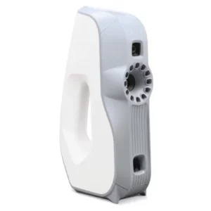
Structured-light 3D Scanner – Artec EVA
The scanner “captures” up to 16 frames per second. These are automatically aligned in real time, making scanning easy and fast. Due to the high resolution, the models produced from the Eva3D data can be used in archeology, medicine, industrial research, to create special effects, etc.
The technical features of the scanner are as follows:
- 3D resolution up to 0.5 mm
- Point 3D accuracy up to 0.1 mm
- Small and compact in size only
- 26.1 x 15.8 x 6.4 cm and weight just 850 gr
- Ideal for fast high-precision object scans, up to 1m, speed up to 288,000 points / sec
- Shooting range 30 ° x 21 °

Long Range Terrestrial Laser Scaner – Optech ILRIS-3D
ILRIS 36D is a complete, fully portable laser scanner system built specifically for topographic surveys, mines – tunnels – mines, archeological sites, industrial applications, monitoring and other applications.
• It is about the size of a Total Station and incorporates a 2 MegaPixel digital camera.
• Has a scan field of 3600 X 3600
• Dynamic scanning range from 3 to 1500 m.
• 2000 points per second regardless of accuracy.
• Special provisions and methodologies that guarantee overlapping between scans.
• High resolution and accuracy of 4 mm.
• Operation through special software on a laptop or palmtop.
• Waterproof IP65.
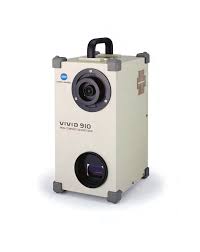
Laser 3D Scanner – Minolta VIVID 910
The Minolta VIVID 910 3D Scanner is a 3D non contact, portable scanner that captures 3D geometry and a color surface illustration. Its principle of operation is based on optical triangulation, through which the captured distinct points of the three-dimensional space (point cloud) are connected to each other in a triangular lattice. More specifically, the object is scanned by a horizontal beam of laser light, which is emitted by the aperture of a cylindrical lens at the bottom of the scanner. The light reflected from the surface of the object is detected by the scanner lens and transmitted to a CCD camera, through which it is converted into distance information. The process is repeated with the light beam scanning the surface of the object vertically from the top to the base through a mirror, which rotates with the help of a precision galvanometer. In this way, a three-dimensional representation of the object is obtained in the form of a dot cloud.
